• JOURNAL
  • Shows
  • CO-LAB
  • About
  • Contact
Menu

Terratory Journal

  • JOURNAL
  • Shows
  • CO-LAB
  • About
  • Contact
JOURNAL ARCHIVE
+YTown Map .6-2_800.jpg
STEPHEN CHALMERS: The Incredible Shrinking City
Read More →
_MG_0404.jpg
THIEU RIEMEN - Atmosphere in Agriculture
Read More →
1509_16_worked.jpg
COREY ARNOLD - Talking Tides
Read More →
BRUCE PARKER - On The Beach Manzanita
Read More →
Braquenier5.jpg
PHILLIPPE BRAQUENIER - Boundaries
Read More →
HARVEY WANG: Remembering Adam Purple
Read More →
Untitled-(Southern-California),-2013-(3).jpg
JUSTIN CLIFFORD RHODY - Land of Enchantment
Read More →
7.Encounter.21.0006.jpg
EDGELAND SPACE: Jennifer Colten
Read More →
Sandmotor-01.jpg
LAND THIEVES: A war on rising tides
Read More →
RUINS: Post-Industrial Society
Read More →
UTILITY POLES: Above or Below?
Read More →
Hwy_63_at_Broadway.jpg
BILLBOARDS: Your Ad Here
Read More →
Corner-of-33rd-and-Edsel-Ford-W,-Detroit-2015_6589359.jpg
DETROIT: Ruralized
Read More →
PHOTOBOOKS: The Golden Age
Read More →
4558-3(R).JPG
SENSE OF PLACE: Tanya Traboulsi
Read More →
Diptych 1 - Ave.H/ Rd. 120, East Lancaster, CA.
IMAGE AESTHETICS: trash or transcendental?
Read More →
MALCOLM KENYON - Calendula Fields
Read More →
CARDINAL DIRECTIONS
Read More →
State_border_1.jpg
BORDERS: Invisible Lines
Read More →
Picket-Line_1.png
URBAN DILEMMAS: What stays and what goes?
Read More →
ROBERT ADAMS: Talks Photography & Environment
Read More →
jackson_cups003.jpg
GREENSPACE: Your happiness depends on it!
Read More →
SHIFT: Rethinking Cars in the City
Read More →
AMERICAN SOUTHWEST: Bone-Dry!
Read More →
DAVE IMUS: The State of U.S. Mapmaking
Read More →
© Robert Adams, courtesy Fraenkel Gallery, San Francisco

© Robert Adams, courtesy Fraenkel Gallery, San Francisco

ROBERT ADAMS: Talks Photography & Environment

October 17, 2015


Written By: Ryan Nemeth

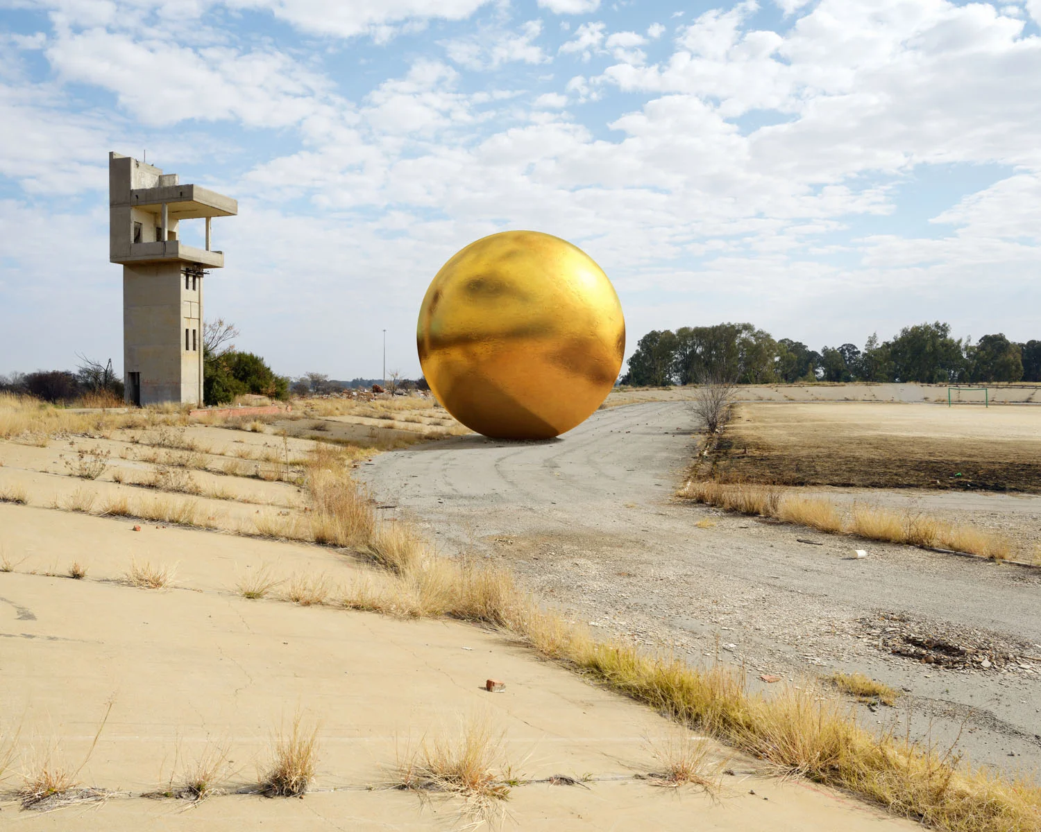
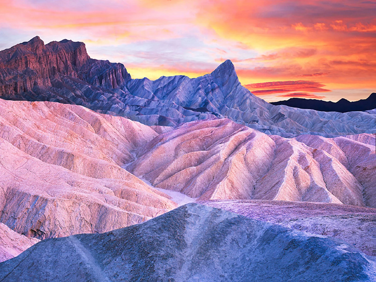
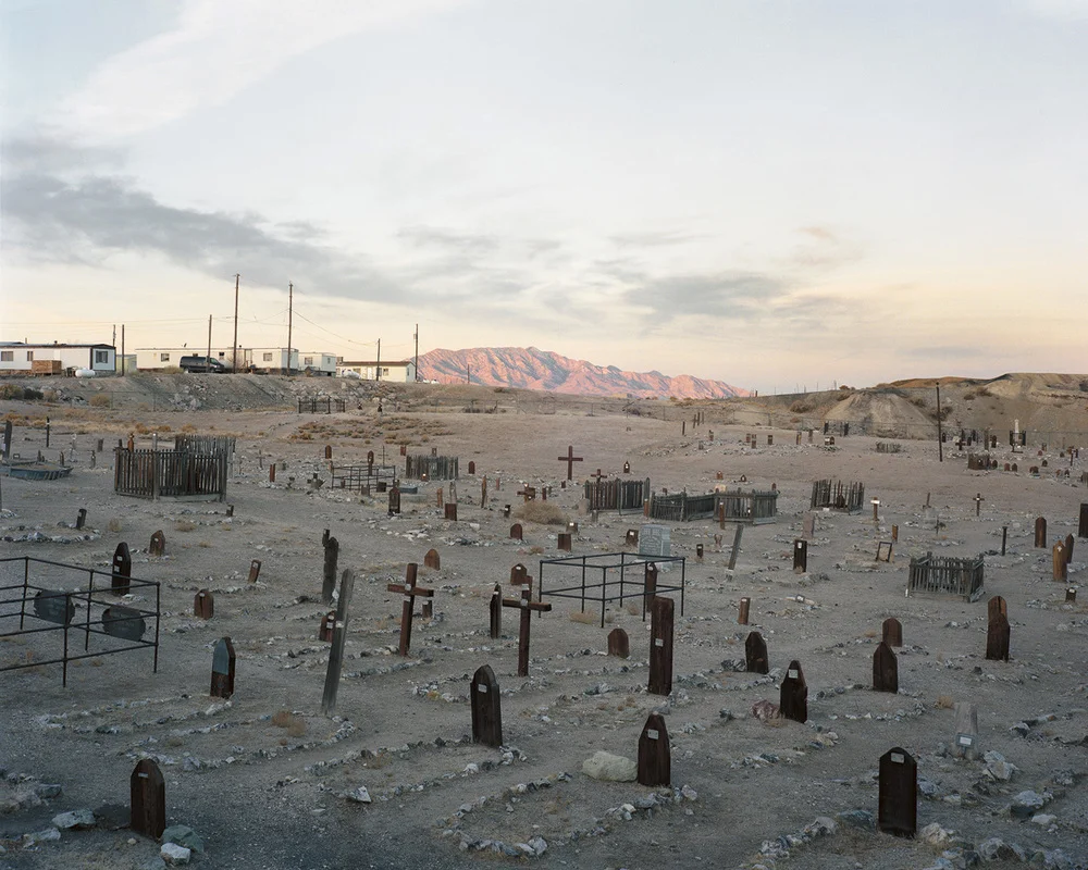
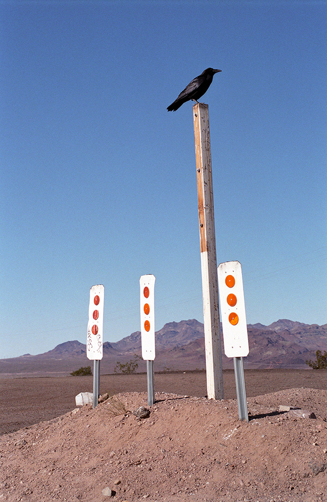
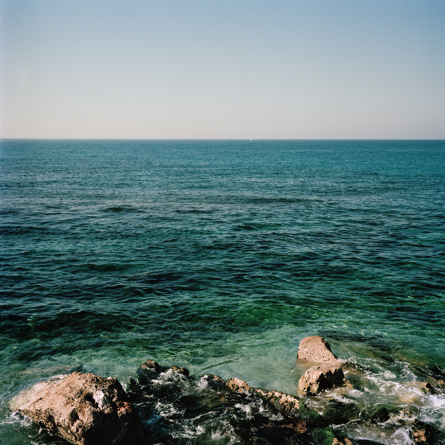
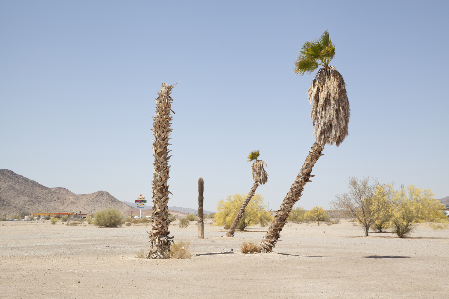
The American West has always been a frontier of sorts for most Americans. Not only is the West still ground zero for epic road trips and custom RV sightings; it serves as space for many of us to co-exist with nature. Living in the American West for most of my adult life, I am convinced that the idea of wide-open space and unadulterated land still represents a blank canvas to most humans. This association of limitless potential embodies the essence of the American West and for that matter still remains at the core of our American identity.  Furthermore, I believe that this cultural concept has made the American West potent for many generations of Americans and immigrants alike. For many, the landmass west of the Mississippi still represents fertile ground, a place of prospect, a land of dreams, and also a place to start anew. However, long gone are the days of the romantic Gene Autry and John Wayne Wild West shows. Yet, the esprit de corps of our famous American cowboys lives on as the American West continues to be tamed by a new westerner, the developer. 

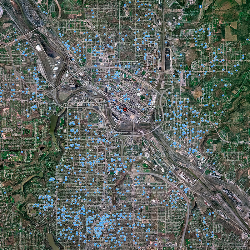
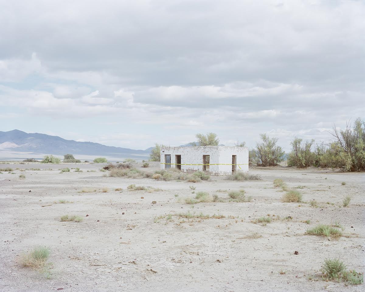
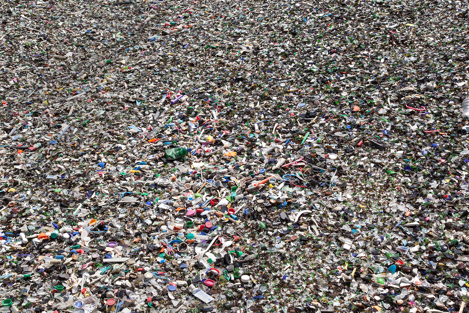
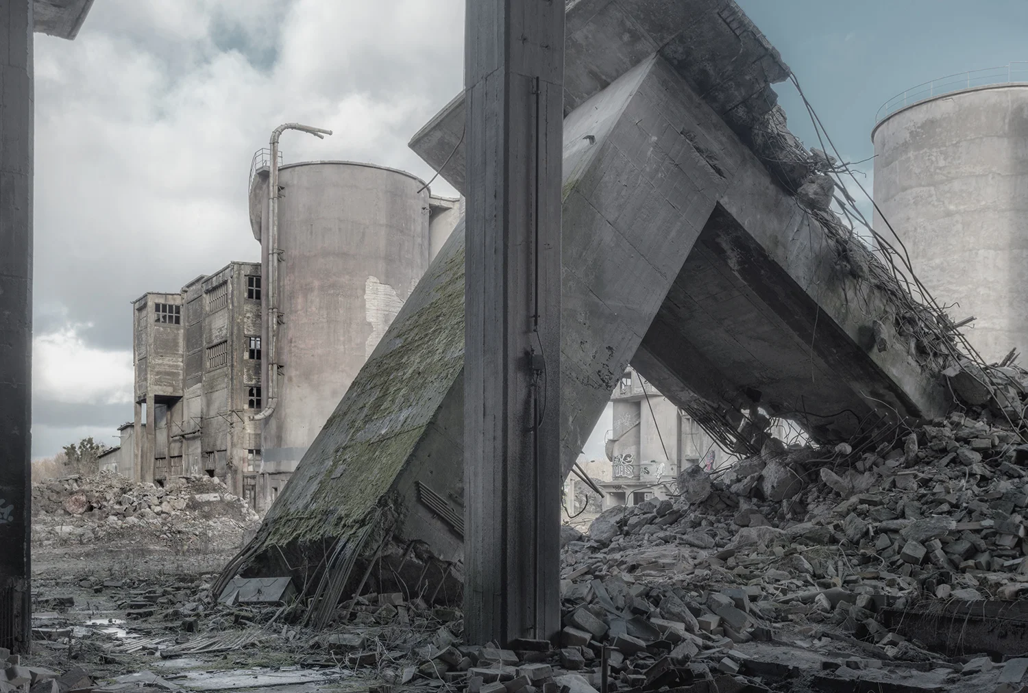
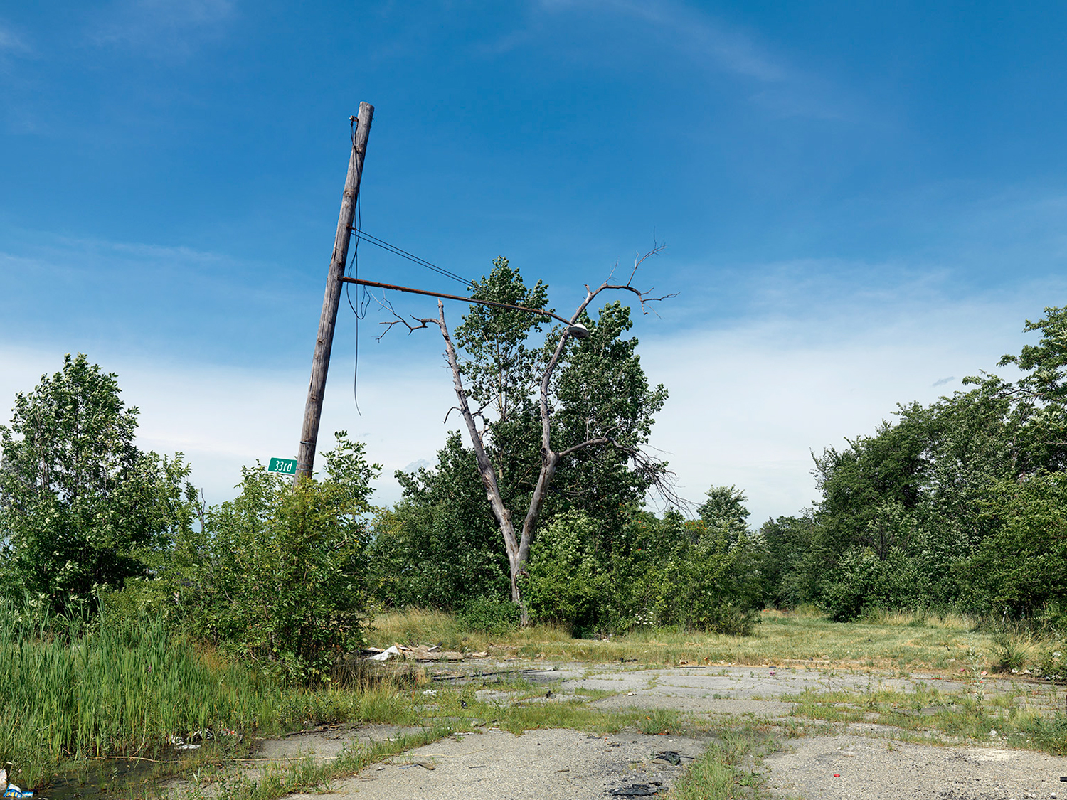
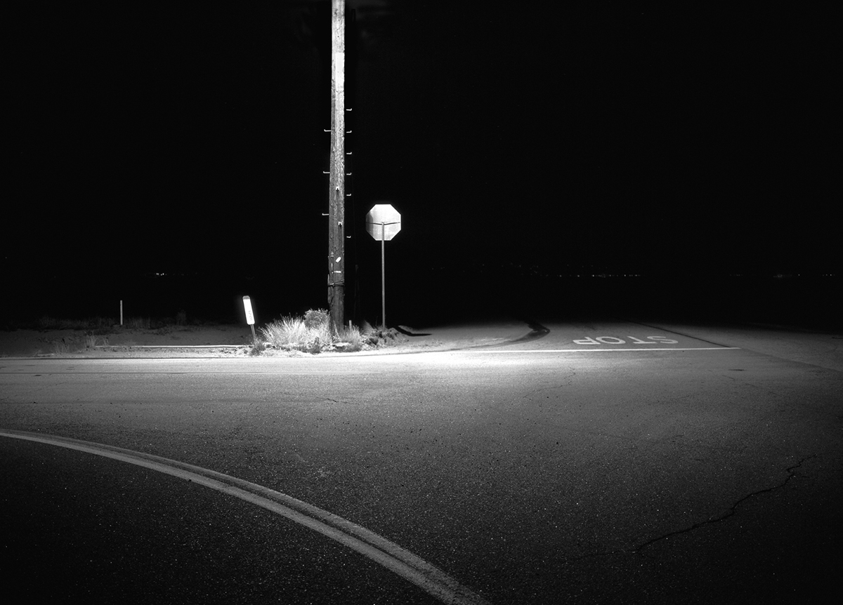
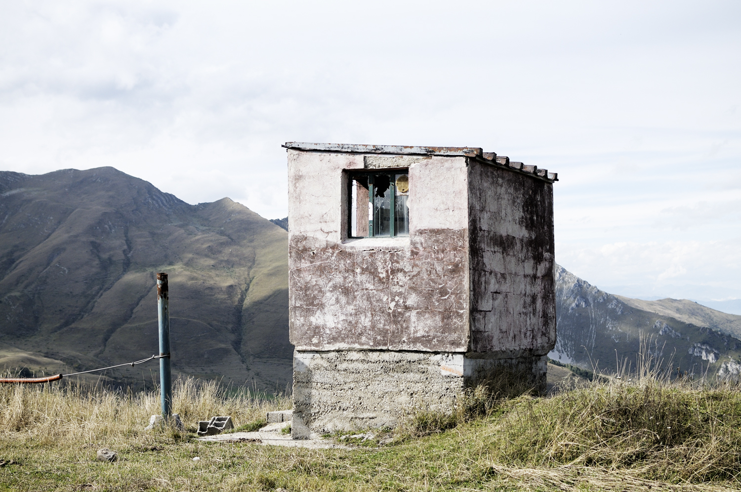
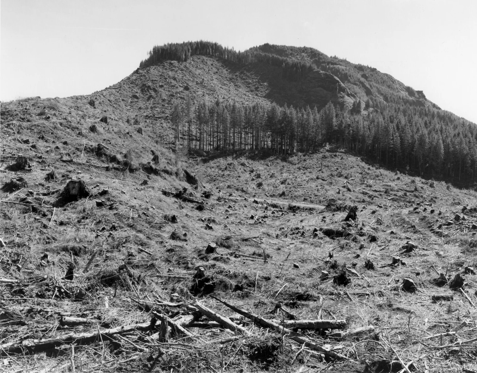
Motivated by automobile access, propelled by cheap gas, and driven by the American dream, many Americans moved west after World-War II.  After all, the weather was nice, land was cheap, and this part of the States and its nostalgia represented the perfect place to start a new life. Thus, we began clearing land and making way for our new beginnings.  In the act of doing so, we reduced forests, paved prairies, and dammed rivers. We replaced pristine western land with shopping malls, strip malls, suburban neighborhoods, and other needed infrastructure to feed the growth of our newfound contemporary cities. What changed and what was challenged were the characteristic environmental spaces that help preserve the identity of our American West. It is evident through many generations of urban and suburban growth initiatives in the West that the majority has still not challenged an age-old formula for urban expansion and growth.  Furthermore, there is evidence to suggest that this formula is not sustainable in the long run. I assert that we have done very little to balance our resource consumption and environmental footprint with our desire to perpetuate new growth and inhabit space in the American West. To this day, in many parts of the West, we continue to cut and carve our way into pristine land and intervene in natural habitat.

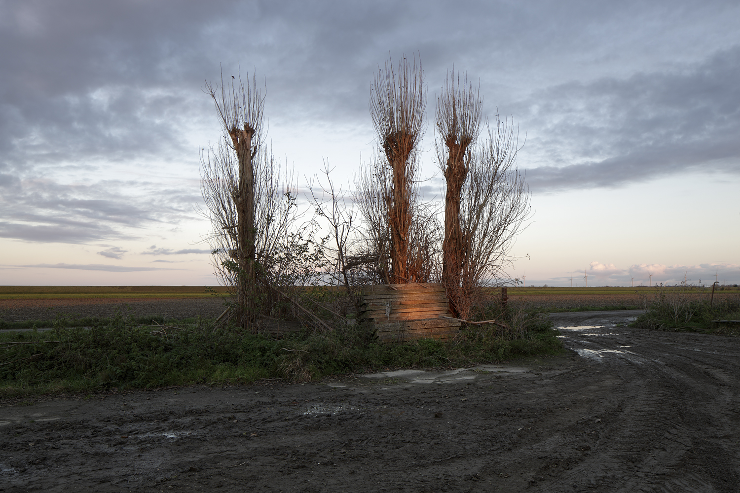
One person that undeniable stood up and questioned these growth initiatives through the lens of his camera was Robert Adams. In fact, Robert Adams has pretty much dedicated his life to documenting and standing up to the environmental degradation and consumer creep inflicted on the American West. He has extensively documented the West’s open plains, forests, endless skies, and winding rivers. Yet, the raw beauty conveyed in his images is almost always juxtaposed with environmental overtones and metaphor of loss. Thus, Adam’s images are somewhat of a paradox as they depict the epic natural beauty of the American West simultaneous to the annihilation of that beauty by industrialization, consumerism, and pollution. As a reader, you should know that prior to Robert Adam’s and the New Topographic show of 1975 there really was no avenue for work of this nature in art photography. Adam’s legacy is that he helped usher in the concept of altered landscape as an art form. Thus, contemporary landscape photographers know a world before and after Robert Adam’s. We should be thankful that he helped secure a seat at the table for environmentally driven art photographers.

Given his stellar career accomplishments, it is easy to consider Adam’s legacy and his role in context to the places that inspired his work. In doing so, I cannot help but reflect on the spirit of the cowboy in the American West and wonder just how Robert Adam’s fits into this picture?  Cowboys are notorious for their land driven lifestyles, their freedom to roam, rugged independence, as well as their ability to break the rules and buck the system. I would argue that within the context of landscape photography, Robert Adams is all of these things and more! 

I had the chance to correspond via mail with Robert Adams about the environment and photography and here is what he had to say:

1. It is apparent in your work that you have a strong emotional bond and connection to nature. Can you attribute your affinity for the natural world to someone or something you have experienced in your life?

My father, bless him, first took me on hikes in the woods when I was three... he carried me on his shoulders.  They are among the first memories I have. We went on to share a love of the outdoors - hiking, camping, river running - for over sixty-years.

The other person who has guided my understanding of nature is my wife Kerstin. She is from Sweden where nature is practically a religion. She’s taught me particularly about animals and their sacredness. She’s just been calligraphing a beautiful aphorism by Porchia, “Even the smallest of creatures carries the sun in its eyes.”

2. Do you feel that the genre of landscape photography has changed over the course of your career? If so, could you elaborate on the changes that you perceive as occurring?

There have been relatively different emphases in landscape photography almost from the beginning.  At one extreme there has been a focus on aesthetic pleasure for it’s own sake, and at the other for the sake of understanding the world. A lot of work is somewhere in between, but there is always going to be a tension.

3. I know that you earned a Doctorate in English; yet, you chose the photographic medium as your preferred method for speaking out about the environment and communicating about landscape, why?

I came to feel that my gifts were primarily visual. Besides, it was more fun to be outside!  Certainly, I could never have written at the level of Wendell Berry, Edward Abbey, or John Hay. 

4. Much of the work you have produced demonstrates an intimate understanding of place. Do you feel that knowing or having a sense of place impacts your photography? If so, how?

I believe that my work is more truthful where I have watched the hours and seasons pass. It helps me to recognize what is characteristic.  And occasionally to hear... There is no way to say this without sounding foolish... the voice behind the other voices.

5. Throughout your career you have been actively involved in taking a stand against clear-cutting and logging activity. In fact, much of your career has been devoted to preserving the health of forests that surround your immediate living environment. What other current environmental challenges are important to you?

Locally, I worry, along with some of our neighbors about LNG (natural gas) terminals and coal and oil trains.  Nationally, my concerns are numerous - fracking, mountain top removal, etc.  But, behind all of these issues loom the stay-awake-at-night terrors; overpopulation, nuclear weapons, and climate change.

6. In keeping with the topic of activism, you have suggested through prior conversations that speaking out about the environment can be a solitary and isolating experience. I believe that this concept provides a powerful perspective on the process of change through activism. Would you elaborate on this idea?

Well, there’s some accuracy to the Turkish proverb that states, ”Tell the truth and be driven from nine villages.” Though as long as you do not make too much trouble, your opponents don’t come looking for you. Though, they don’t come asking you to be on their commissions either. But, the amount of activism that Kerstin and I have attempted has largely been limited by time and energy.  

7. Some photographers produce their work around a central theme or concept. Others shoot freely and then edit their work to identify common themes that can be consolidated and grouped together for a series of work. Can you elaborate on your process for creating a new body of work? How does the creative process work for you?

A lot of projects seem to start with more or less accidental discoveries, then you build on them!  Of course, even an afternoon of random exploration is shaped by your life’s values.  John Sarkowski had a wonderful and funny piece of advice when he thought something was stuck, he would say, “Just kick the tripod a little.”  

8. In thinking about the future of environmental activism through the lens of photography, what advice might you offer to those of us who are trying to change the world through imagery? Is there reason for hope? 

I wish I had some practical advice. When I look back over Kirsten’s and my life, it seems that we were saved by luck and discipline and the help of family and friends.  When it looks dark, I sometimes remember a line from Pablo Neruda’s speech: “I saw so many honorable misfortunes, lone victories, and splendid defeats.” Also, I should mention that once or twice I have repeated to a photographer a blessing that was formulated by the Spanish philosopher Miguel de Unamuno: “May God deny you peace, but give you glory.” He was thinking, of course, of Don Quixote. 

FREE JOURNAL SUBSCRIPTION

FREE BI-ANNUAL ISSUES of TERRATORY JOURNAL - Sign up with your e-mail address.

We respect your privacy.

Thank you!
Image by: Thomas Jackson - Cups #3

Image by: Thomas Jackson - Cups #3

GREENSPACE: Your happiness depends on it!

October 17, 2015


Written By: Ryan Nemeth

Urbanization, defined as the increase in the number of cities and urban population, is not only a demographic movement but also includes social, economic, and psychological changes in population. Urbanization is a process of industrialization and economic development that leads to concentrated population growth and human habitation in built environments.  In today’s increasingly global and interconnected world, over half of the world’s population (54 per cent) live in urban environments. Notably, there is still substantial variability in the levels of urbanization across countries. The coming decades will bring profound changes to the size and spatial distribution of the global population. The continuing urbanization and overall growth of the world’s population is projected to add 2.5 billion people to the urban population by 2050, with nearly 90 per cent of the increase concentrated in Asia and Africa. At the same time, the proportion of the world’s population living in urban areas is expected to increase, reaching 66 percent by 2050.

The process of urbanization historically has been associated with other important economic and social transformations. These changes have ushered in greater geographic mobility, lower fertility rates, longer life expectancies, and aging populations. Thus, cities are important drivers of development and poverty reduction as they concentrate national economic activity, government, commerce, and transportation activities. Furthermore, metro areas provide crucial links with rural populations and access and availability to resources between cities. Urban centers even have an impact that can be felt across international borders. This is increasingly the case with the rise of the service class and the Internet economy, as city and population resources have been mobilized. 

Nevertheless, we all know that rapid and unplanned urban growth threatens sustainable development. This often transpires when necessary infrastructure changes are not planned and developed properly, or when policies are not implemented to ensure that the benefits of city life are equitably shared. Today, despite the comparative advantage of cities, urban areas demonstrate more inequity than rural areas as hundreds of millions of the world’s urban poor live in sub-standard conditions. In some cities, unplanned or inadequately managed urban expansion leads to rapid sprawl, pollution, and environmental degradation. I would propose that the role of green space in cities is and will become increasingly important for the maintenance of urban ecology and sustainable development. Furthermore, including ample green space in densely populated areas will serve as a necessary and needed connection to our broader environment and a lifeline to the natural world.  Urban environments are particularly challenged because they insert humans into built environments that are increasingly diminished and void of nature. Thus, the mere action of sequestering humans from the natural world seems to induce many of the reported ill-fated effects and unintended consequence of urban existence. 

Just as rats and other laboratory animals housed in unfit environments undergo systematic breakdowns in healthy and positive patterns of social functioning, so too do people. In greener settings such as rooms, buildings, neighborhoods, and larger areas with more vegetation; we find that people are more generous and more desirous of connections with others. In these settings, we find stronger neighborhood social ties, a greater sense of community, more mutual trust, and a willingness to help others. In general, healthy natural environments show evidence of healthier social functioning in both neighborhood and common space areas. Thus, research indicates that there is more (positive) social interaction in green space and a greater shared use of space by both adults and children. In less natural environments, the inverse is true. We find higher rates of aggression, violence, violent crime, and property crime; even after controlling for income and other differences. Researchers also noted increased rates of loneliness and that more individuals reported having inadequate social support in environments void of natural elements.

Access to nature, whether it is in the form of bona fide natural areas or in bits or views of nature, impacts psychological, as well as social functioning. Greater access to green views and green environments yields better cognitive functioning; more proactive behaviors, more self-discipline, and more impulse control; greater mental health overall; and greater resilience in response to stressful life events.  Less access to nature is linked to exacerbated attention deficit/hyperactivity disorder symptoms, more sadness, and higher rates of clinical depression. People with less access to nature are more prone to stress and anxiety, as reflected not only in individuals’ self-reports but also through measures of pulse rates, blood pressure, and stress-related patterns of nervous system and endocrine system anxiety. The evidence is very conclusive!

Rarely do the scientific findings on any question align so clearly. Parks, nature, and other green environments are an essential component of a healthy human habitat. While street trees, parks, and public green spaces are often regarded as mere amenities; ways to beautify our communities and make life a little more pleasant. The science tells us that they play a central role in human health and healthy human functioning. Much like eating greens provides essential nutrients, so does seeing and being around green growing and alive flora and fauna. To promote a healthier, kinder, smarter, resilient, and more vital populace, communities should be designed to provide every individual with regular and diverse sources of “Vitamin G.” For those of you wondering, that is the green vitamin, nature, the one that we naturally ingest through our senses.    

Ironically, just at the moment in our evolutionary history when we have turned decisively toward an urban existence with less and less contact with nature, scientists studying the impacts of the physical environment on people have discovered the importance of our connection to the natural world. In the last two decades, research on the impacts of green environments show that humans social, psychological, and physical health has burgeoned. The evidence for the link between nature and human health has become so convincing that researchers have taken to using the phrase “Vitamin G” to capture nature’s role as a necessary ingredient in a healthy life (Maas, 2008). Much as nutrition scientists have discovered that fruits and vegetables play a crucial role in a healthy human diet, environmental scientists have discovered that trees, parks, and natural elements play an essential role in a healthy human habitat.

Conclusion: Protect, Interact, and Contribute to maintaining and creating green space in our cities, our collective health and vitality depends on it!

References:

  1. Kuo, J. (2010). Parks and Other Green Environments: Essential Components of a Healthy Human Habitat. National Recreation and Parks Association.
  2. Maas, J. (2008). Vitimin G: Green environments-healthy environments. New England Journal of Medicine, 325(24):1740-2. Utrecht: Nivel.
  3. Srivastava, K. (2009). Industrial Psychiatry Journal. Jul-Dec; 18(2): 75–76. Retrieved from: http://www.ncbi.nlm.nih.gov/pmc/articles/PMC2996208/.
  4. United Nations, Department of Economic and Social Affairs, Population Division (2014). World Urbanization Prospects: The 2014 Revision, Highlights (ST/ESA/SER.A/352).

FREE JOURNAL SUBSCRIPTION

FREE BI-ANNUAL ISSUES of TERRATORY JOURNAL - Sign up with your e-mail address.

We respect your privacy.

Thank you!
Image by: Akos Major

Image by: Akos Major

SHIFT: Rethinking Cars in the City

October 17, 2015


Written By: Dylan Morgan

Edited By: Ryan Nemeth

Each morning most Americans walk out to their cars and begin a circuitous commute. Our routes typically include multiple collector streets, highway interchanges, and some degree of frustrating traffic congestion. As a designer, I spend most of my time in traffic wondering how we will ever recover from the past century of urban planning and infrastructure design. If you look back in American history, you find that our modern system of highways and suburban neighborhoods were largely incentivized and designed around a great American product, the internal combustion engine automobile. Now that our cities are filled with car-centric elements such as highways, parking lots and low-density sprawl, how can they be adapted to create a future environment that is less oil dependent, less polluting, and more walkable?

Before we can address our current transportation problems we must understand the DNA of our cities. An abbreviated history of America’s transportation infrastructure goes something like this: In the 1940s, Pacific City Lines (PCL), a subsidiary of General Motors, Standard Oil, and Firestone Tire and Rubber began buying streetcar lines in many U.S. cities and offering to replace them with bus systems. By 1950, PCL had allowed many of the new bus systems to fail and urban residents were left without public transit in most U.S. cities. This process, known as “the Los Angelizing of America,” was the result of a strategy from then GM chairman, Alfred Sloan. Sloan’s strategy and coinciding efforts shifted federal funding away from public transit infrastructure and instead promoted highway construction projects.  In the form of the Federal Highway Acts of 1944, 1956, and 1968, the government adopted Sloan’s proposal and began building an elaborate system of highways leading both to and throughout our cities. These new paths for mobility were designed exclusively for the car and they still support a coinciding suburban lifestyle where home life is connected to the rest of our daily needs largely via a singular mode of transportation. It is important to note that this car-centric vision became the standard for urban growth throughout the mid-20th century. 

The truth about the efficacy of Sloan’s plan is that America was built within a system of roads and highways that have become inadequate for our current urban needs. With America and the rest of the planet continuing to transition to urban lifestyles, we have largely exceeded our capacity to efficiently add more drivers to the road.  It seems that with each increase in the number of vehicle lanes and alternative routes, the traffic levels simply continue to rise and we find ourselves once again stuck in gridlock. The time has come to envision American cities that are sustainable by design and therefore run efficiently. However, without good precedents for repairing our current urban fabric, we find ourselves at a loss for proven solutions.

As our awareness of the true social and environmental cost of driving has increased in recent years, urban designers, myself included, have begun to villainize the car.  However, given our current urban fabric, we will likely have to keep our newfound enemy close. In fact, most of our recent innovations in urban mobility have come through technological and business model innovations as applied to the automobile. Services like Uber and Car2go have introduced flexible car sharing models that pair easily with other transit modes and take advantage of our existing infrastructure. Take for example, Google’s automated car and similar crash-prevention systems already installed in many vehicles. These technologies are examples of what I see as a viable solution for our new urban transportation needs. As Americans, we have long tried to reestablish streetcar systems, pedestrian plazas, and bike lanes.  However, our low-density urban environments inherently prevent these systems from experiencing the popularity and efficacy found in European cities, for example. Thus, it is implied by both our history and culture that a major shift in transportation will likely still involve the car as means for transportation in urban America.

Perhaps the latest car innovations can provide inspiration for a new American streetscape. One where cars become less of a dominant force and instead serve as the link between other modes of transportation. It is compelling to imagine a city where the presence and role of the automobile is reduced. Hypothetically, this would allow our streets to become; efficient instead of wasteful, free-flowing instead of congested, quiet instead of loud, clean instead of dirty, safe instead of dangerous, and shared instead of owned. As far out as this concept sounds, the technology to achieve this new urban reality already exists and is primed and ready for adoption.

Moving forward, I believe that the efficient movement and mobility of people has to be central to our new vision and strategy for transportation in urban space. After all, our obsession and love for our cars got us into this trouble in the first place. We have allowed the dominance of a single transit mode and the concept of individual car ownership for all to restrict our ability to adapt our cities to contemporary transit needs. If a single transportation method has proved to be inflexible; then certainly a more diverse approach to transit will likely better serve us in this time of urban and environmental flux. With this lesson in mind, let’s turn our attention to the biggest problem of the 21st century, keeping people connected to resources such as jobs, education, food, and shelter in our rapidly growing and fast-moving cities.

As mentioned, I believe that several solutions for improving both the mobility and the livability of urban environments can be supported by a new version of the automobile. However, I am also an advocate for adopting new fuel sources for our vehicles as well as changing the way that we utilize our cars. Personally, I see a bright future in fleets of electric automated cars that can be shared or rented in order to open up access to other modes of transportation. Here is a short list of several benefits that could be gained by utilizing fleets of automated electric cars in our cities:

  • Automated cars will solve one of the biggest concerns for urban residents: parking. Without the need to retrieve our privately owned cars from a parking lot, cars will be free to find parking in many of the underutilized spaces within the city. Automobiles will park with unimaginable efficiency. The next car in line will simply be available as needed and each interchangeable with the next. Those with low batteries will return to a charging station in an out-of-the-way location. This new spatial efficiency will accommodate greater density, thus, reducing the need for motor vehicles and increasing the quality of life in the city.
  • Automated cars will provide mobility to the elderly, the young and the disabled; while also safely transporting the drunk and the injured.
  • Networked cars will prevent congestion by seamlessly merging and redistributing traffic for maximum efficiency. Cars will be customized to respond differently to each neighborhood they travel through. With an awareness of travel delays they will reroute themselves and take better advantage of surface streets. Traveling slow at times and fast at others, networked cars will increase efficiency and safety for all transit modes.
  • With the goal of zero fatalities becoming a real possibility, automated cars will safely share the road with pedestrians and bicyclists increasing the space for these alternate modes of travel as well as their popularity.
  • Electric cars will eliminate air pollution and reduce noise pollution on the street edge, further benefitting pedestrians and cyclists.
  • Automated electric car fleets will be used as large batteries to retain solar power and redistribute energy in times of low sun.
  • Shared automated cars will be used as “last mile” vehicles to connect people with other transit options such as pedestrian streets, streetcars and bike share systems.
  • Automated vehicles will improve productivity by allowing people to work during their commute. Traveling in an automated car will be an extension of your office or your home. Perhaps even joining you indoors after you arrive at your destination. This will lead to less time-sensitive travel.
  • Shared automated vehicles will be a critical part of the public transportation system providing suburban mobility to those unable to afford centralized housing and increasing access to resources such as jobs and groceries.
  • Automated highways will provide an alternative to flying, greatly reducing carbon emissions and conserving limited oil resources.

References:

  1. Dunham-Jones, Ellen. Retrofitting Suburbia. John Wiley and sons. 2011.
  2. Millard, Bill. Urbicide: selected case studies. In Content, by Rem Koolhaas. Koln: Taschen. 2004. p. 40-43.
  3. Nelson, Arthur C. Reshaping Metropolitan America: Development Trends and Opportunities to 2030. Washington, DC: Island Press, 1995.
  4. Safdie, Moshe and Wendy Kohn. The City After the Automobile: An Architect’s Vision. New York: Basic Books, 1997. 

FREE JOURNAL SUBSCRIPTION

FREE BI-ANNUAL ISSUES of TERRATORY JOURNAL - Sign up with your e-mail address.

We respect your privacy.

Thank you!
Image by: William LeGoullon - Palms

Image by: William LeGoullon - Palms

AMERICAN SOUTHWEST: Bone-Dry!

October 17, 2015


Written By: Ryan Nemeth

In a recent LA Times Op-Ed, NASA scientist, Jay Famiglietti estimated that California has only one year of water left in its reservoirs (Sneed, 2015). I have to admit that I was a little shocked when I learned just how dire the California drought has made the water situation in the Golden State. For me, the truth around water consumption is that humans are not good at rationing and protecting resources they cannot see. Water is an interesting renewable resource as we humans tend to believe that our access to H2O is limitless. Thus, we expect to turn on the spigot and see water. The problem being is that our consumption never really correlates with an ability to monitor and manage personal water reserves. Therefore, shared and invisible resources such as H2O makes the task and personal responsibility associated with resource management that much more complicated.  

The fact is that we are currently weathering a huge Western drought and the scope of the problem and conversation around water should not be limited to just California. With snow packs in the West at their lowest levels in 100 years, it makes the conversation about solutions to overcome water scarcity issues very real.  Beyond California, the Colorado River Basin is the main water supply and lifeline of the Southwest. A new study by NASA and University of California Irvine scientists, finds more than 75 percent of the water loss in the drought-stricken Colorado River Basin since late 2004 came from underground resources. The extent of groundwater loss may pose a greater threat to the water supply of the Western United States than previously thought (Rasmussen, 2014).

According to the U.S. Bureau of Reclamation, the federal water management agency, the basin has been suffering from prolonged, severe drought since 2000 and has experienced the driest 14-year period in the last hundred years. Monthly measurements in the change of water mass from December 2004 to November 2013 revealed the basin lost nearly 53 million acre feet (65 cubic kilometers) of freshwater. That's almost double the volume of the nation's largest reservoir, Nevada's Lake Mead (Rasmussen, 2014). This puts large metropolitan areas serviced by the Colorado river system like Los Angeles, Phoenix and Las Vegas at extreme risk for water related issues in the very near future.

Lake Mead’s elevation is currently just 1,087 feet above sea level and dropping steadily. Another 12 feet and the most severe drought-protection program the Southwest has ever seen will be triggered. If and when Lake Mead hits 1,075 feet, the government will declare a federal water shortage for the seven states that draw water from the Colorado River, forcing Nevada and the others to limit water use. Worse, a report by climate scientists and NASA predicts the Southwest will be in a decades-long drought by mid-century, the worst in 1,000 years. Despite the sobering predictions, former Las Vegas water czar Pat Mulroy is confident life will go on in the West (Phillips, 2014). I tend to agree with Mrs. Mulroy, but I also believe that life will have go on in a very different way, kiss your yards and golf courses goodbye!

We must be aware of the fact that Americans’ water footprint per person is larger than any other country in the world.  To identify solutions to the problem, it is imperative to understand how water is consumed here in the States. Given the fact that each of us on average consumes more than the rest of the globe, most people are not aware that the personal consumption of water only accounts for 10 percent of our total fresh water consumption in the U.S (IFAD, 2015).  This statistic is usually a shocking fact for most Americans.  Many Americans believe that water conservation efforts should be focused on reducing the personal consumption of water.  Thus, most of us would tend to think that 2-minute showers, low-flow toilets, efficient household appliances, and xeriscaping are the solutions to our H20 problems. These variables are definitely a part of the solution, but the statistics noted below show that the bigger problem lies in H2O consumption associated with our food and Agro-Industrial systems.  

Roughly seventy to eighty percent of fresh water is currently used for commercial and agricultural needs and another ten percent for industrial use. Combined, the total commercial and industrial use of H20 accounts for roughly 90 percent of our total water consumption in the United States (IFAD, 2015).  Without a doubt the bulk of our fresh water is diverted to irrigation systems in order grow crops. Thus, conversations about where and how we grow our food seem to be the conversations that may have the most potential to shape our current water conservation efforts. What makes this conversation particularly difficult in the Golden State is the fact that California grows roughly 50% of our fruits, vegetables, and nuts in the United States.  Thus, California leads in water consumption for farming with 24.4 billion gallons consumed a day, one-fifth of all irrigation water in the U.S. (Fishman, 2015).  This number eludes to the problem that the Central Valley is an inhospitable environment for many of the water-intensive crops that are grown there. In fact, it is suggested that not much would grow in the Central Valley without irrigation systems. This really begs the question, should we be building large Agro-Industrial food complexes in areas of our country that require huge fresh water diversions? Both economics and national security interests would probably suggest that this is not the best idea in the world.

On a positive note, the United States uses less water as a nation than it did in 1980, when total use was 440 billion gallons a day.  In the last 30 years, the U.S. has more than doubled its GDP, and added 70 million new citizens while reducing total our water use. In economic terms, we use less water to produce an economy of $13 trillion than we did to produce an economy of $6 trillion, this is dramatic progress. Most of it comes in efficiency from power generation and farming. Farmers, overall, use 15% less water than they did in 1980, but produce 70% more food. That's a total increase in farm-water-productivity of almost 100% and this is huge (Fishman, 2015)! For me, the supply side solution to our problem lies in innovation and new technology that will increase water cycle efficiencies in agriculture and industry. Thus, I believe that we need to increase subsidies and economic incentives to encourage water and irrigation innovation. Doing so effectively would increase the supply of fresh water available for irrigation and commercial production.  Clearly there are expensive ways like desalinization to increase our water supply, but what I am suggesting is increased efficiency as part of the solution rather than to try and exclusively rely on methods for increasing our water supply. We must also confront the demand-side of this issue, thus, we must also find constructive ways to reduce our water footprint and to discourage waste and inefficient demand in the system. I believe that both supply-side and demand-side conservation will ultimately be a part of the solution to H20 scarcity, but we must begin to target intensive use areas like agriculture if we have any hopes of solving the larger problem. 

References:

  1. Alley, R. (2000). Ice-core evidence of abrupt climate changes. PNAS vol. 97 no. 4 pgs. 1331–1334, doi: 10.1073. Retrieved from: http://www.pnas.org/content/97/4/1331.full#ref-list-1.
  2. Fishman, C. (2015). The big thirst: the secret revolution in U.S. water use. Fastcompany.com. Retrieved from: http://www.fastcompany.com/1748537/big-thirst-secret-revolution-us-water-use.
  3. IFAD, No author. (2015). Water facts and figures. Retrieved from: http://www.ifad.org/english/water/key.htm.
  4. Phillips, A. (2015). Water experts discuss actions Southern Nevada has taken and what we should plan for. Lasvegassun.com. Retrieved from: http://lasvegassun.com/news/2015/mar/22/water-expert/.
  5. Rasmussen, C. (2014). Parched West is using up underground water.  NASA Jet Propulsion Laboratory, CIT. Retrieved from: http://www.jpl.nasa.gov/news/news.php?release=2014-242
  6. Sneed, A. (2015). California is about to run out of water, we have to act now. Wired.  Retrieved from: http://www.wired.com/2015/03/californias-run-water-act-now/.

FREE JOURNAL SUBSCRIPTION

FREE BI-ANNUAL ISSUES of TERRATORY JOURNAL - Sign up with your e-mail address.

We respect your privacy.

Thank you!
Image by: Ryan Nemeth - Northwest of Dave's House

Image by: Ryan Nemeth - Northwest of Dave's House

DAVE IMUS: The State of U.S. Mapmaking

October 17, 2015


Written By: Ryan Nemeth

Dave Imus is no stranger to place as he and fellow cartographer Pat Dunlavey produced a masterpiece of a map titled, “The essential geography of the United States of America.”  Working in two-inch sections at a time, the map took Imus two years and roughly 6,000 hours to complete. The end result earned Dave Imus cartography’s highest honor, the Cartography and Geographic Information Society’s (CaGIS) Best In Show Award for 2010.  As the matter of fact, Imus has earned this distinction on four separate occasions over the course of 20 years. Thus, making him America’s most celebrated mapmaker.

What does it say for the state of mapmaking when a two-man team of cartographers is capable of producing maps that exceed efforts from the Central Intelligence Agency, the U.S. Census Bureau, and National Geographic?  Clearly, there is no question that Imus is a gifted cartographer and that his maps should be celebrated. However, his accomplishments could easily lead one to question the efficacy of both geographical systems and geographical knowledge at the institutional level in the United States.  Yet, another assessment of the situation is that these institutions simply lack the design sensibility, aesthetic training, and coinciding design skills necessary to produce detailed high quality maps. In fact, if you were to ask Dave Imus about this topic, he would tell you just that. In an interview, he stated his concern, saying, “We lack basic and necessary geographical information here in the United States.” In probing Imus about this assertion, he attributes much the problem to the quality of mapmaking here in the United States. The end result is that Americans lack good contemporary maps and geographical resources that are widespread and available.  I should mention that Imus has devoted his life to being a part of the solution, as his life’s work pushes American cartography in the direction of both science and art.

For Imus, it is evident that the occupation of cartography is as much design as it science. Thus, Imus is concerned as much about the layout of the information in his map as the geographical content and information contained within the map.  Both components are necessary and critical elements of a good map. In fact, much of Imus’s self-proclaimed competitive advantage may be found in this attribute. Imus explained that good mapmaking comes down to “clarity”.  Thus, it is implied that what might be lacking in most contemporary institutional and corporate maps is in fact this, “clarity”. Via modern technology, cartographers possess the capacity to generate the needed scientific and geographic knowledge within a map like never before.  However, what Imus suggests is that both the distillation and articulation of this information is what sets a good map and bad map apart; herein is the “art” of mapmaking.

It just so happens that Dave Imus lives an hour and half south of me outside of Eugene, Oregon. So who wouldn’t want to hop in the car and drive to a farmhouse in the middle of grass seed country to talk cartography, geography, and renaissance?  Yep, this is exactly what I did! Here is the interview that transpired with our celebrated American mapmaker:

Ryan:  Dave, I appreciate you taking the time to meet with me to elaborate on the art of map-making. Let’s jump right into the subjects of geography and cartography. I know that you have commented extensively on discrepancies you observe between American’s and European’s knowledge of geography. What do you think the difference is in the level of geographic knowledge between the two continents?

Dave:  I have a lot of thoughts on this subject! Europeans have had access to maps of general geography for over 400 years. Artistically, European general geography maps are on par with American botanical and medical illustrations. Similar to botanical and medical illustration, mapmaking is a science-based art. However, in the United States mapmaking has not benefited from the artistic treatment realized elsewhere, such as Europe, or more specifically in Switzerland, where cartography has exceled.  

Ryan:  Do you think this geographical deficiency has something to do with technology and a move towards more automated map-making processes? Is it a process problem or something beyond?

Dave:  It’s a process issue. I think most of the difference in quality and expression between European and American maps stems from our dissimilar cartographic origins. European mapmaking started 400 years ago and was valued for its geographic expression. American mapmaking started more recently as an expeditious representation of data. For example, Rand McNally’s first maps were railroad maps that they made to promote rail travel. These maps benefited Rand’s primary business, the printing of railroad tickets.

Ryan:  It is evident that maps could easily aid business interests, especially for businesses involved in infrastructure and transportation industries. Our current satellite imagery might be no different? It seems that the widespread availability of satellite imagery has also spawned many new business ventures with commercial mapmaking interests.

Dave:  Are you old enough to remember free maps at gas stations?

Ryan:  Barely! I think we paid a quarter or so for these maps when I was really young.  However, these paper road maps were always something to wrestle with during a road trip. I remember my dad opening those maps up and it felt like an air bag had been deployed in the car.

Ryan and Dave:  Hah Hah.

Dave:  These free maps serve as really good examples of commercial maps that are very pedestrian in nature.  However, they were never intended to be maps of geographic expression. This being said, we do need aids to navigation, therefore there is a place for navigational maps such as Google maps. However, if you want to understand the land rather than just move through it in space, you need maps with much more expression and concise geographic information! In fact, I think widespread geographical literacy is impossible without quality resources that portray basic geography.

Ryan:  I feel like more and more my generation seems to be traveling in space without a keen awareness or interest in place or our surroundings. Most of the time, the question is how do I get from point A to B as fast as possible? We are definitely a generation that relies on computer-mapped routes as a primary means for our navigation. What might we be missing out on?

Dave:  I think what you describe points to a general lack of appreciation for basic geography. This simply is a lack of appreciation for basic characteristics of the land. It is possible that we need to approach geography from a wider vantage point, such that geography is enjoyed rather than being merely employed as a tool to serve our needs.  Seen through a geographic lens, the land is a thing of great beauty. In fact, observing attributes of land and admiring basic geography should be similar to noting the beauty of flowers. The more closely we look at flowers, the more beauty we see. The same can be said of the world when viewed through a geographic lens.

Ryan:  Great point! I am going to switch topics here. What are we doing to make our maps more expressive? Has mapmaking evolved and how is the commercial side of the industry progressing?

Dave:  Take for example a big mapmaker like National Geographic; they are currently producing revisions of essentially the same map they have made for a long time.  The shaded relief components of their current maps are their old hand drawn shaded reliefs. I should mention that these are not science based shaded relief sections. In fact, they are highly impressionistic in nature!

Ryan:  And the National Geographic map has looked like this for how long?

Dave:  I believe that National Geographic’s map of the United States is based on a design that they have employed since the 1940s. This was an era in American mapmaking when we were not concerned with producing high quality products. Thus, I see National Geographic’s maps as the geographic information equivalent of a 1971 Oldsmobile. Unfortunately, these maps are still sold commercially and I believe they are the reason Americans continue to suffer geographically.

Ryan:  Wow! This begs the question, what can be done about this? Do we possess the skills to change the quality of our contemporary maps here in America? Or better yet, could there be a renaissance in mapmaking here in America?

Dave:  Oh there will be, this is my goal and has been for a while! I feel that given the arc of my career that I am in a position to help influence a new direction in American mapmaking.  I hope that my maps are already doing this!

Ryan:  What are some of the barriers that exist that prevent us from taking a new direction in mapmaking?

Dave:  In my case, I feel that my maps are not understood. To my map-making colleagues, my maps look like just another map. Not too long ago, the head of cartography at the Smithsonian reviewed the Essential Geography of the USA, the map I produced that won the CaGIS award.  His review was obtuse; it was evident that he totally misunderstood that he was reviewing the first general map ever made of the United States of America.  This map was made to an artistic standard that American cartography does not embrace.

There are a lot of great mapmakers in America, but they are not great artists, they are great scientists. For example, medical illustrators are trained in medicine and then they are trained in the art of medical illustration. Cartographers are trained in geography and the science of cartography, but they are not trained in the art of geographic illustration, which is what cartography is at its heart.  American cartographers go out in to the world with scientific skills, making them scientists, not artists. Because they are not artists, many cartographers do not understand the value of spending 6,000 hours on a map. To many of my peers, but certainly not all of them, they believe the amount of time I spend making a map is mystifying. However, to me, maps are worth the time and effort.  I see huge potential to have a geographically engaged society through these efforts!

Ryan:  So in parting, how do we get there, how should cartography proceed and what should change?

Dave:  For a long time, I believed geographic literacy would benefit if cartographers placed greater value on design. Now, I believe we need an entirely new movement in cartography that is artistic at its core. The ultimate solution would be to train cartographers in geography and the art of cartography, without much attention paid to technology.  A solution could be found in academic training and generated by implementing design oriented cartographic curricula.  Currently, there are many barriers as our cartography curricula are still driven by industry standards that do not embrace artistry. Also, I believe that there needs to be a second mapmaking society in the U.S., one that focuses on cultivating art and design in the profession.  This is what the industry should pursue if we hope to produce high-quality geographic resources for the American public.  

Ryan:  It sounds like we could really benefit from change in the industry, I am all for it!  Additionally, thanks for taking the time to share your thoughts. This has been an enlightening discussion!

You can find Dave Imus and his amazing maps here: imusgeographics.com

FREE JOURNAL SUBSCRIPTION

FREE BI-ANNUAL ISSUES of TERRATORY JOURNAL - Sign up with your e-mail address.

We respect your privacy.

Thank you!
Image by: Dillon Marsh - Freestate Goldfield #5

Image by: Dillon Marsh - Freestate Goldfield #5

ECONOMICS of DIGITAL PHOTOS: What is the value?

October 17, 2015


WRITTEN BY: RYAN NEMETH

The economic laws of supply and demand are at play in the global art market and they influence the price of a piece of art as well as photographs.  To further the discussion, there are three key economic concepts that must be investigated to provide a basic economic framework for an understanding of image pricing.  These concepts are the laws of supply and demand as well as the economic principle of price elasticity.

Original works of art, such as unique one of a kind paintings are obviously limited in supply. Inversely, photography by its very nature has historically been a medium that is based on print production and producing multiple works from a negative.  Inherently, this production capacity makes photography a medium that has traditionally been tied to the concept of a series of work; mainly due to the capacity for the production of multiples.  Therefore, The price of a photo is usually much lower than that of a unique piece of art (ex. an original oil painting) because printed photographs are less scarce and there is the capability to produce an abundant supply.

The law of demand states that if all other factors remain equal, the higher the price of a good, the less people will demand of that good. In other words, the higher the price, the lower the quantity demanded (see Graph 1 below). The amount of a good that buyers purchase at a higher price is less because as the price of a good goes up, so does the opportunity cost of buying that good. As a result, people will naturally avoid buying a product that will force them to forgo the consumption of something else they value more. In the graph below, lines D1, D2, and D3 represent different levels of consumer demand in the market. Line D2 represents lower demand whereas line D3 represents higher demand. Like the law of demand, the law of supply demonstrates the quantities that will be sold at a certain price. But unlike the law of demand, the supply relationship shows an upward slope (See Graph 1 below). This means that the higher the price, the higher the quantity supplied. Producers supply more at a higher price because selling a higher quantity at a higher price increases their revenue (Heakel, 2015). Lines S1, and S2 represent different levels of market supply. Thus an increase in suppy would be represented in an outward shift from line S2 to line S1 in the graph.

Graph 1:

Untitled.jpg

(Sparknotes, 2015)

It is common knowledge that the current photographic market is transitioning through changes that relate to the adoption and integration of disruptive technology as applied to the medium. Digital technology has been disruptive to photography because it has increased the production capacity of image making while cheapening post-production and storage costs. Inherently production has therefore increased because the Internet has enhanced the capacity to both share and store images in online environments. Thus, we can infer that the cost of making and sharing a photo has decreased to a price that is not much more than the cost of someone’s time. Because the cost of production is minimal, the supply of photographs has become seemingly limitless.  Applying the law of supply to this market change enables us to deduce that there is downward pressure on the aggregate price of photography in the market.  In the graph above, an increase in the supply of photographs moves the supply curve from S2 to S1, with a corresponding downward movement of price from P3 to P1 as quantity expands from Q2 to Q1.

As evidence in her 2013 report, Mary Meeker (2014) estimated over 500 million photos are being shared every day, she predicted this activity would increase twofold by the end of 2013 compared to 2012. Today, the share volume is estimated at 1.8 billion images per day and is over three times compared to 2013 estimates. Moreover, the Meeker report pointed out that only 30 percent of overall mobile subscribers own a smartphone. What can be inferred is that there is a widen gap that could further expand the number of photos shared per day (Meeker, 2014).  This data points to the idea of sustained downward pressure on market pricing because of an increasing photo supply.  Many seasoned photographers complain about how tough the market is today.  One considerable factor should be the simple economics of the situation. Increased competition and the noted exponential increase in the supply of photography drives the price for photos and photographic services down as there is more competition in the market. The exponential sharing capacity of the Internet makes the photo market that much more difficult as it heightens downward price pressure.

Graph 2:

Untitled2.jpg

(Penn State University, 2015)

However, contrary to the implied downward supply side price pressure in the market are other economic and price indicators that suggest the economic concept of elasticity of demand is also at play. For example, recently there have been record-breaking prices at auction for fine art photographs by notable artists. This price and market behavior stands in direct contrast to the implied downward pressure created by an overall exponential increase in the supply of photographs. This market behavior is fully explained by the economic concept of elasticity of demand, see Graph 2 above. Price elasticity is a measure of the relationship between a change in the quantity demanded of a particular good and a change in its price. Price elasticity of demand explains price sensitivity in the market. If a small change in price is accompanied by a large change in quantity demanded, the product is said to be elastic or responsive to price changes. Inversely, if a product is inelastic, a large change in price is accompanied by a small amount of change in quantity demanded (Investopedia, 2015).

In the case of the current online photo market, it is assumed that a miniscule amount of the 1.8 billion shared images online actually has substantial, if any commercial value? Given this assumption, the bulk of photographs online exhibit an almost perfectly elastic demand curve. Thus, very small increases in price would affect the demand for these images greatly. For example, moving to an online model of paying for images would suggest a huge drop off in the market demand and consumption of online imagery.  Conversely, the photos sold recently at auction by famous and notable photographers have demonstrated an almost perfectly inelastic demand curve. Christopher Mahoney the head of Sotheby's photographs department commented in Coline Milliard’s (2014) article, he stated, “The market for classic photographs has never been stronger, with eight prices over $500,000, the 2014 auction demonstrated the enormous appetite among a broad base of collectors for top-tier photographs from the 19th and early-20th centuries."  This commentary suggests that near perfect inelastic market demand exists in some areas of the fine art photo market. Thus, consumers demand coveted photos at almost any price!  An economic explanation of the recent auction market suggests that a very limited supply of photos or even unique images coupled with intense demand creates this pricing escalation.

In conclusion, it could pay to actually limit the size of print editions and photographic works that are distributed in online environments. If an artist has enough demand for their work, this strategy might create a much more inelastic demand curve and higher prices for their photos and books. It is suggested that small runs of photos, books, and printed materials might actually hold their value better when distributed selectively through digital and online channels of distribution. It can also be inferred that satisfying market demand through increased production beyond demand may not be a wise strategy in terms of long-term photo valuation.

Seller Beware! 

References: 

  1. Heakal, Reem. (2015). Economic basics: supply and demand. Investopedia.com Retrieved from:             http://www.investopedia.com/university/economics/economics3.asp. 
  2. Investopedia.com (2015) Price elasticity of demand. Retrieved from: http://www.investopedia.com/terms/p/priceelasticity.asp.
  3. Meeker, M. (2014). Internet trends 2014, code conference. Kleiner, Perkins, Caufield, Byers. Retrieved from: http://www.kpcb.com/internet-trends.
  4. Milliard, C. (2014). Sotheby’s sets new world record for photography auction. Retrieved from: https://news.artnet.com/market/sothebys-sets-new-world-record-for-photography-auction-199945.
  5. Penn State University (2015). Elasticities and demand curve shapes. Retrieved from: https://www.e-education.psu.edu/drupal6/files/ebf200/images/0203b.jpg

FREE JOURNAL SUBSCRIPTION

FREE BI-ANNUAL ISSUES of TERRATORY JOURNAL - Sign up with your e-mail address.

We respect your privacy.

Thank you!
Image by: Bart Van Damme - Hedwigepolder, Zeeland, Netherlands.

Image by: Bart Van Damme - Hedwigepolder, Zeeland, Netherlands.

CHARLES HATFIELD: The Rainmaker

October 17, 2015


Written By: Ryan Nemeth

This month, I turned on Public Broadcasting to catch the tail end of a radio report devoted to Charles Hatfield, otherwise known as the “Rainmaker”. I find it no coincidence that there is renewed public interest in water scarcity issues given the drought we face in the American Southwest. Thus, the idea of manufacturing rain seems like a very logical place for concerned citizens to pick up conversations around issues of water scarcity and production. Yes, you heard me right, there was and still is a profession devoted to making rain, queue the snake oil salesman!

To this day, a lot of people believe that Charles Hatfield was nothing more than a seedy profiteer. However, the case for the legitimacy of rainmaking was challenging in a very compelling way by Hatfield in a 1915 contract with the city of San Diego, CA.  By the end of 1915, San Diego was in its fifth year of drought and the city reservoirs of Morena and Otay were nearly empty. With water supplies threatened, the nervous City Councilmen gave verbal acceptance to Charles M. Hatfield’s offer. He boldly pledged to fill the reservoirs through his rainmaking services in exchange for $10,000 (Crawford, 2008).  

Ten days after Hatfield began operations near the Morena Reservoir, it started to rain. In fact, over the next two weeks, more than seventeen inches of rain fell in the mountains. The San Diego River rose and the Mission Valley flooded. In the flood, the Tijuana River carried away the farming settlement of Little Landers, which landed down river just north of the Mexican border. Roads and bridges disappeared and a second storm arrived on January 25th, bringing another foot of rain. As the reservoir crested, water topped the Sweetwater dam, which eventually gave way. All said and done, the ensuing damage and floods left 14 people dead and destroyed countless homes and farms throughout the valley (Crawford, 2008).

Oblivious to the scale of the havoc and with their mission complete at the Morena Reservoir, Charles and Paul Hatfield walked sixty miles back to San Diego and presented City Hall with their bill for $10,000. City Attorney Terence Cosgrove showed the brothers the door, explaining there was no written contract for their “rainmaking” and the deluge was “an act of God.” The brothers brooded for nearly a year and then filed suit on December 2, 1915. Cosgrove offered to settle with Hatfield, but only if he accepted responsibility for the $3,500,000 in damages caused by the flooding (Crawford, 2008). The “Rainmaker” declined on the deal, but his actions bring into question the validity of this mysterious practice.  Was rainmaking an actual legitimate profession and more importantly did it work?

In pondering these questions, I began to wonder how rainmaking even came about?  The history goes something like this; as far back as the first century A.D., Plutarch made the observation that rain follows battles, and nine centuries later, soldiers returning from the Civil War were still convinced this was true, having slogged through the mud of so many battlefields (Fountain, 2003). This idea explained, to the satisfaction of some, the storm that handicapped the Spanish Armada, as well as the torrential rains that followed the fireworks celebration for the opening of the Erie Canal (Ward, 1889).  History also reveals that there was widespread popular belief in a causal link between fire and rain. For example, there were many recorded accounts that the great Chicago fire caused a severe rainstorm (Owens, 2008). 

Notably, these theories were Americanized after the Civil War by a man named Edward Powers, who wrote War and The Weather, contending that most of the Civil War battles caused rain. Congress, pressed by influential Senators who owned Western land and hoped there might be something to these theories, spent over $20,000 testing the explosion or concussion theory. However, the concussion theory faded out after the trial testing in Texas failed miserably (Patterson, 1970).

Departing from the concussion theory, by the early 20th century, scientists and pseudoscientists were beginning to focus on what makes precipitation. The scientific research was instead centered on tiny particles called condensation nuclei around which rain droplets form. Vincent Schaefer, a General Electric researcher made the discovery that cooling a cloud would create ice crystals that could then act as condensation nuclei. It was from this discovery that modern cloud-seeding was born and legitimate projects to produce precipitation have since been based (Fountain, 2003).

Although many modern scientists will refute the efficacy of Hatfield’s rainmaking efforts, I happen to believe that Charles Hatfield’s and other notable rainmakers should receive recognition for their efforts.  If anything, rainmakers helped carry the concept of rain production forward into something of commercial viability.  For me, this fact is both interesting and a little unsettling, as I am not sure how I feel about the idea of manipulating the water cycle. What should be noted irrelevant of human attempts to make rain is that there is a huge distinction between changing the weather and controlling the weather. Sure modern cloud seeding demonstrates that the capacity for rainmaking is real, but its effects still remain fleeting and not fully controllable.  Despite our best efforts, I believe that weather is a beast that shall never be tamed. Furthermore, I think that the Charles Hatfield story is a shining example of this lesson, be careful what you wish for!  

References:

  1. Crawford, R. (2008). 1916: The year a rainmaker says he ended city's drought. San Diego Union Tribune. San Diego: CA.
  2. Fountain, H. (2003). Ideas & Trends; The Science of Rain-Making Is Still Patchy. New York Times. Retrieved from: http://www.nytimes.com/2003/10/19/weekinreview/ideas-trends-the-science-of-rain-making-is-still-patchy.html
  3. Patterson, T. (1970). Hatfield the Rainmaker. The Journal of San Diego History. Vol. 16 (4). San Diego: CA. Retrieved from: https://www.sandiegohistory.org/journal/70winter/hatfield.htm.
  4. Macbride, M. (1911). With Napoleon at Waterloo and other Unpublished Documents of the Waterloo and Peninsular Campaigns. pp. 181-185. J.B. Lippincott Co. Philadelphia: PA.
  5. Owens, L.L. (2008). The great Chicago fire. ABDO Publishing Company. Adina: MN.
  6. Ward, R. (1889). Artificial rain, a review of the subject to the close of 1889. The American Meteorological Journal, Vol. 8. Ann Arbor: MI.  

FREE JOURNAL SUBSCRIPTION

FREE BI-ANNUAL ISSUES of TERRATORY JOURNAL - Sign up with your e-mail address.

We respect your privacy.

Thank you!
Image by: Thieu Riemen

Image by: Thieu Riemen

LANDSCAPE: Altered or Unaltered?

May 29, 2015


Written By: Ryan Nemeth

Scanning the format of landscape photography these days I cannot help but notice two distinct categories of photographs. The first category of photograph is generally a depiction of scenery or unaltered or uninhabited land, a more accurate description of this image is raw scenery rather than landscape. Although not always true, I would categorize this type of image as an objective look at the land. These images are steeped in romantic expression as they are suggestive of pristine landscapes both unaffected and untouched by humans.  This type of image is also suggestive of what was and what should be? Thus, unaltered images of scenery generally serve as a reference point to contrast a world and space that is now occupied. As Frank Gohlke stated, our affection for land runs deep, national parks and pristine community spaces occupy a huge part of our psychological connection to land. Thus, many of the images that bear an association with these pristine spaces reinforce the notion of human beings disconnection from land. Images of this type are also highly suggestive of what has been lost, which I would argue is what makes images of this type so relevant to the viewer.  I believe that good landscape photographs occupy this psychological space within the mind of the viewer. Thus, romantic images of scenery often generate a sense of longing in the viewer and it is in this tension through emotional provocation that meaning and value is often constructed.  

The second defining category of landscape photograph depicts altered and inhabited space that is a derivative of the constructed landscape. Although not always the case, these images are generally much more subjective and interpretive in nature. It is within this category of image that the viewer is induced to move from the concept of raw uninterrupted land and scenery to an understanding of an occupied world. I believe that images of this type inherently occupy a more pragmatic and realistic space within the minds of viewers as these images tend to depict objective realities in regard to human interaction with land.  As J.B. Jackson pointed out, “a landscape only exists as something imagined, created, used or viewed by a human being. Therefore, there is no pure before image, only an endless sequence of afters.  A man altered landscape is therefore a record of construction and disruption both social and physical, beneficial or detrimental”. Jackson’s insights help to make a clear delineation between the two distinct categories of photography centered on the subject of land. Thus, there are romantic images of unaltered scenery and landscapes or altered depictions of land.  

This being said, Jackson would have argued emphatically that these two categories (scenery and landscape) of land based photography are inseparable and must coexist together. For Jackson, Landscape implied the coexistence of both human and natural underpinnings. Therefore, no deep channel separated the human world from the natural. Landscape was both technological and biological, an economic product and an aesthetic object, full of intentions and yet always the product of chance.  Landscape is nature forged with steel, through electric illumination, and atop asphalt.  Jackson believed that through these constructions, “humans deliberately create space to speed up or slow down the process of nature.”

As Jackson was aware, most students of the subject believed otherwise. On the one side of such schemes stood the romantic notion (of writers like Henry David Thoreau) that we are part of nature and should value natural powers above human creation. Romantics favored picturesque cities whose roads and buildings rambled along the swells of topography and the grains of local materials. On the other side was the humanist/pragmatic attitude (of those like Thomas Jefferson) that the human shape is supreme and that we must control nature. Pragmatists advocated for the gridded plan where right angles clipped, hedged, and hacked back natural color, texture, and form in the guise of reason and utility.

Both philosophies, Jackson realized, while at opposite ends of the spectrum, used a priori reasoning. That is to say, they first defined a relationship between human and natural, and then applied that definition as the basis for appropriate environments. Such reasoning, according to Jackson, was flawed. Excluded in such deductive thought were the unpredictable freedoms of the individual spirit and senses. As he wrote: “All that we can now do is produce landscapes for unpredictable men where the free and democratic intercourse of the Jeffersonian landscape can somehow be combined with the intense self-awareness of the solitary romantic.” Landscape had to satisfy both functional demands and reflective aspirations, therefore demonstrating physiological and psychological requirements.

References:

  1. Gohlke, F. (2009) Thoughts on Landscape. Tucson, AZ: Published by Holart Books.
  2. No author, (2010) New Topographics. Gottingen, Germany: Steidl Publishers and Center for Creative Photography in cooperation with the George Eastman House.
  3. Schwarzer, M. (2014) Selected books by J.B. Jackson. Retrieved from: http://www.harvarddesignmagazine.org/issues/6/selected-books-by-j-b-jackson.

FREE JOURNAL SUBSCRIPTION

FREE BI-ANNUAL ISSUES of TERRATORY JOURNAL - Sign up with your e-mail address.

We respect your privacy.

Thank you!
Image by: Sadie Wechsler

Image by: Sadie Wechsler

WAYFINDING: Understanding Place

May 29, 2015


Written By: Ryan Nemeth

Wayfinding encompasses all of the ways in which people and animals orient themselves in physical space and navigate from place to place (Wikipedia, 2014).

The perpetual pulse of capitalism and corresponding growth in urban environments has given rise to new challenges for human navigational strategies and our concept of space.  Exploration of the subject of technological wayfaring exemplifies one more way in which the human race exhibits limited interactions with the natural world. Both the technological revolution as well as growth in urban environments, have given rise to the age of the global positioning system (GPS).  As we all know, GPS systems are well on their way to being a ubiquitous standard feature in every car and on every cellphone. Because of the widespread availability of GPS, human beings are depending on these systems for navigation more than ever.

The potential implications for this dependency on GPS are vast as neuroscientists have recently uncovered that navigational activity in fact helps to develop and shape our brains. Experts informed by this research have postulated that permanent changes could occur in the human brain as we grow accustomed to navigation driven by computers and machines.  Once we lose the habit of forming cognitive maps, it is quite possible that our sense of direction may become compromised (Hutchinson, 2009).  These findings should raise some red flags for those of us that may be concerned about the long-term effects of computers and artificial intelligence on the brain.

Iaria and McGill University researcher Véronique Bohbot demonstrated in a widely cited 2003 study that human mapping strategies fall into two basic categories. One is a spatial strategy that involves learning the relationships between various landmarks thereby creating a cognitive map in your head.  In other words, your brain produces an image of a map where destinations are referenced relative to one another on something similar to a street grid. The other is a stimulus-response approach that encodes specific routes by memorizing a series of cues. For example, a commoninternal dialogue that accompanies this approach may be, get off the bus when you see the glass skyscraper, then walk toward the big park, at the fountain take a right. For their study, Iaria and Bohbot created a virtual maze that tested both methods; they found that about half of us prefer spatial strategies, while the other half prefer stimulus-response (Hutchinson, 2009).

The idea that we carry maps in our heads is relatively new. An experimental psychologist at the University of California, Berkeley, Edward C. Tolman, coined the term “cognitive map” in a 1948 paper showing that rats in certain types of mazes were able to figure out shortcuts to a destination a clear sign that they weren’t simply learning a sequence of left and right turns. Amazingly, a series of experiments in the 1970s suggested that cognitive maps are more than metaphorical. Certain neurons in the hippocampus, called “place cells,” were observed activating only when the rat was in a specific place. Let the animal wander through a maze, and you could watch a chain of neurons fire in a spatial pattern that exactly matched its path, at a smaller scale (Hutchinson, 2009).

Donlyn Lyndon, professor of architecture at Berkeley and the editor of Places, described place as spaces that can be remembered and hold memories through formal structures and events (Tate, 2007). Generally we experience notable places first hand through our own unique experiences and also second hand through the experiences of others, thus, knowing and understanding place exists through personal memory as well as collective social memory.  Places and manifestations of places are thus both projections of the mind as well as environments that occupy physical space. Attributes and associations of place are known, depicted, and shared in large part through memory and therefore memory associations seem to play an integral role in human’s ability to effectively navigate their environment (Hutchinson, 2009).

The beauty of GPS devices is precisely that we no longer have any need to painstakingly assemble cognitive maps. But Cornell University human-computer interaction researcher Gilly Leshed argues that knowledge of an area means more than just finding your way around. Navigation underlies the transformation of an abstract “space” to a “place” that has meaning and value to an individual. Furthermore, this understanding is linked to the brains hippocampus and its corresponding growth and function (Hutchinson, 2009).  

What researchers do know is that the hippocampus readily adapts to increased and decreased navigational demands in this region of the brain (Hutchinson, 2009).  What is yet to be determined is just how this will effect human development over time. Irrelevant of the suggested physiological changes in the brain, our dependence on GPS most definitely distances us from complex interactions with our environment and the natural world. I believe that this ever increasing division and interruption between man and the natural world is what we should be concerned about! Furthermore, this points to the realization that our world is rapidly become a virtual environment, which is a reason for indifference.

The combination of newer navigational instruments produces an increase in efficiency and a corresponding loss of skill. In modern navigation, with a complexity of instruments and techniques, the computational abilities of the mind of the navigator penetrate only the shallows of the computational problems of navigation. In the day to day practice of navigation, the deeper problems are either transformed by some representational artifice into shallow ones or not addressed at all. This phenomenon is important because skill, according to Albert Borgmann, is at the heart of social and environmental engagement (Aporta & Higgs, 2005).

But what if in that perfect representation of the world boundaries between the map and the territory become blurred and something important about the human experience of space becomes lost? Do some technologies encourage disengagement from experience of the land, people, and culture? It would seem that these new geographic technologies may have the potential to transform local geographies into standardized and measurable space and in so doing to suppress or diminish the spatial and wayfinding skills of local peoples (Aporta & Higgs, 2005).

GPS technology is, in many ways, the perfect device to demonstrate how human dependency on machines has the potential to divorce us from interactions to the natural world. First, it creates the possibility of orientation that depends entirely on the devices ability to portray position and movement and indicate direction of travel. Thus, engagement with local conditions becomes increasingly unnecessary. The GPS receivers answer to a spatial question (e.g., where to go) is provided by a mechanism that is physically detached from it (a network of satellites) and requires no involvement of the traveller with the environment. Although the act of physical travel will always involve some connection with the surroundings, this connection is shallow (Aporta & Higgs, 2005).  I do not think than anyone could argue against the benefits and efficiency that GPS and other navigational technology affords us but we should know that it comes at a cost, only time will tell just how sizable that cost is, buyer beware!

References:

  1. Aporta, C. & Higgs, E. (2005). Satellite Culture: Global Positioning Systems, Inuit Wayfinding, and the Need for a New Account of Technology. Current Anthropology, 46(5), 729-753.
  2. Hutchinson, A. (2009). Global Impositioning Systems, Is GPS technology harming our sense of direction. Retrieved from: http://thewalrus.ca/global-impositioning-systems/?ref=2009.11-health-global-impositioning-systems&page=.
  3. No author, Merriam-Webester (2014). Place. Retrieved from: http://www.merriam-webster.com/dictionary/place.
  4. No author, Wikipedia.com (2014). Wayfinding. Retrieved from: http://en.wikipedia.org/wiki/Wayfinding
  5. Tate, A. (2007). Spatial recall: the place of memory in architecture and landscape. Landscape Journal, 26(2), 328-329.
  6. Walton, A. (2014). The Environment is (Still) Not in the Head: Harry Heft & Contemporary Methodological Approaches to Navigation and Wayfinding. Visible Language, 48(2), 34-47.
  7. Widlok, T. (1997). Orientation in the wild: The shared cognition of Hai||Om bush-people. Journal of the Royal Anthropological Institute, 3, 317-332.

FREE JOURNAL SUBSCRIPTION

FREE BI-ANNUAL ISSUES of TERRATORY JOURNAL - Sign up with your e-mail address.

We respect your privacy.

Thank you!
Image by: Bryan Schutmaat

Image by: Bryan Schutmaat

READING LANDSCAPES: through photos

May 29, 2015


Written By: Ryan Nemeth

As a landscape photographer, I have to admit that interpreting and reading the landscape can at times be very challenging. Not only is subjectivity involved in this process, but we are also challenged by the fact that landscape as an archive and readable medium can be tough to decode.   One of my aims as a photographer is to learn and to understand how we as humans utilize land as a resource and how we choose to live and shape our lives relative to land we live on. It is important that those that try and interpret and read landscape make themselves aware of some of the limitations and factors which may skew one’ s ability to assess and understand patterns and themes of landscape. Thus, there are common variables associated with landscapes that prevent us from seeing land and man associations, both in truth and objectivity. 

First of all, if we think of common landscapes as documents, it is obvious that they are documents written by many different authors. Rarely were all of those authors trying to “say” the same thing, and that is the reason why the “messages” we read from landscapes often seem contradictory. To say that human landscape is a complex document is a cosmic understatement. In any landscape, a variety of readings are not only possible, but also inevitable and even necessary. For those who are seeking final, unambiguous answers about the nature of the human condition, landscape is not the place to look.

Second, the creators of human landscapes do not all receive equal attention from those who try to read it. Some very important landscape makers have been perversely neglected in the traditional literature of landscape reading: women, gay people, poor people, and members of ethnic minorities, to mention but a few. Landscapes that are made by members of the Establishment, by contrast, receive inordinate attention: buildings designed by famous architects or the stately houses of wealthy people. Theoretically, at least, we ought to try to read all landscapes, no matter who was responsible for making them. It is especially important to try to do that when we are trying to gain insight into the lives of ordinary, unlettered people. If we truly believe that landscape is a lens that lets us look into the lives and societies of ordinary folk, scholars must necessarily pay special attention to the landscapes those ordinary people created. That does not always come easily. There are plenty of lordly plantation houses strewn across the South, but very few sharecroppers’ cabins survive. Thus, our view of landscape is skewed, partly because of what we choose to notice, partly because of what is actually there.

Third, to decipher meaning in ordinary landscapes is inherently more difficult than interpreting other kinds of historic documents. Written documents, for example, like diaries, essays, or newspaper stories, commonly are signed by their authors. They are meant to be read. If scholars are in doubt about what those written documents mean, they can ask the author to explain, or they can read what other commentators have written on the subject. But most ordinary human landscapes carry no signature and certainly cannot be attributed to any single person. Nobody can be tagged for the responsibility of making most commonplace landscapes, and there is seldom any identifiable person we can ask about what those landscapes mean.

Fourth, like all physical artifacts, landscape is a selectively incomplete document. Even in the United States, where human landscapes tend to be fairly new by global standards, the older parts have eroded over time, or are gone completely. Although New York City was founded in the early seventeenth century, there are virtually no structures in contemporary New York that predate 1800. Only the street patterns persist, and even some of those have been altered. That is why landscape is sometimes likened to a palimpsest: it is a document, to be sure, but a document that has been partly erased, smudged, and then written over, seemingly by people with illegible handwriting.

The final caveat is basically epistemological, and it relates not to the landscape as object, but to the eyes and minds of those who set out to read it. Because each of us sees a landscape with different eyes, the same landscape can be seen and interpreted in different ways. Some of these interpretations contradict one another, but that should neither surprise us nor disappoint us. When people set about to interpret the world, contradictions are inevitable. Recently we have heard strident claims that there are “right” ways and “wrong” ways to look at landscape. To take but one example, some “new cultural geographers” have contended that there is a “postmodern” way of interpreting landscape that is inherently superior to old-fashioned ways of looking, which are dismissed as “positivistic” or simply “traditional.”

The land remains as a physical, psychological, cultural, biological, scientific, and geological frontier, which begs for our attention.  As much as we think we know we about landscape we still have no clue about many complex man and land based interactions. The truth is that contemporary lifestyles are placing tremendous demands and pressures on traditional views of land as a resource.  The constraints and progressions of modern life and technology are pushing us to adapt and to learn to utilize and interact with land in different ways. I think that it is important to acknowledge that landscape is most definitely an active and participatory concept that is constantly being reshaped and challenged by human innovation and ideas. Therefore, landscapes are literally and figuratively being constantly deconstructed and reconstructed. Part of the beauty of trying to define and understand landscape is that you cannot fully grasp or hold this concept as it is dynamic and changing. Thus, landscape and its meaning is out there to be wrestled with and I believe that meaning is often inferred and best understood through a holistic approach to discovery that is multi-disciplined.  One of the disciplines that provides value and helps to shed light on landscape is the vocation of photography. 

Photographs are means for exploring landscape; they are powerful documents as they provide us with concrete evidence of what was. In many cases, landscapes have changed so much and at such a voracious pace that photos, drawings, and other written documents are all that we have as evidence of prior landscapes. The beauty of the digital revolution and the relevant explosion in digital imaging and photography is that we are capturing and documenting space and places like never before.  My assessment is that we are in some ways absolving many of the concerns laid out in prior sections of this article. For example, photos and related imaging technology are giving us much more data and information about our environment. Thus, we are able to discover and understand and frame biological and geological changes relative to human behavior in ways that were not possible without the advent of technology. It should be understood that the photograph is a powerful tool in the discovery and understanding of landscape.  As a medium for landscape discovery, photographs provide humans with another powerful tool that allows us to learn and adapt to our environment. It is interesting to think about how the photograph itself will help to shape our modern landscape or is already doing so?  Social media sites like Pintrest are allowing us to share functional and efficient design through photos. I can’t help but assume that this type of photo media is impacting and shaping our landscape in tremendous ways.

References:

  1. Wilson, C., Groth, & Paul, E. (2003). Everyday America : Cultural Landscape Studies after J. B. Jackson. Berkeley, CA, USA: University of California Press. ProQuest ebrary. Web. 21 January 2015.

FREE JOURNAL SUBSCRIPTION

FREE BI-ANNUAL ISSUES of TERRATORY JOURNAL - Sign up with your e-mail address.

We respect your privacy.

Thank you!
poetry3-final.jpg

DIANE CORSON - Moonlight Snow

April 30, 2015


MOONLIGHT SNOW: by Diane Corson

moonlight as snow


where snow lies on the tree branches

spilling to the deck below


through a window spilling over the sill

puddling and whitening there


brought a presence that awakened

eyes asleep


the light it spread was flat

loud from the humors of the moon


moon still in its knowledge

awakening and anointing minds


the light it spreads flattens

the sparkles now meant to glow

just inside the window

FREE JOURNAL SUBSCRIPTION

Sign up with your email address to receive news and updates.

We respect your privacy.

Thank you!
← Newer Posts

JOURNAL SEARCH

ARTICLE DATES
  • January 2016 4
  • June 2016 3
  • July 2016 3
  • August 2016 1
  • November 2016 1

NEW ARTICLES

Featured
NICOLE STAROSIELSKI - Circuits to the Past
Nov 10, 2016
NICOLE STAROSIELSKI - Circuits to the Past
Nov 10, 2016
Nov 10, 2016
Aug 4, 2016
MARK FRANK - Shin-do-fu-ji; The Practice of No Till Farming
Aug 4, 2016
Aug 4, 2016
ANDREA LOMBARDO - Light Pollution
Jul 23, 2016
ANDREA LOMBARDO - Light Pollution
Jul 23, 2016
Jul 23, 2016

FOLLOW US


SOCIAL FEEDS 


INSTAGRAM

#landscape #altered #blackandwhite #bnw #abstract #terratoryjournal #terratory www.terratory.org
#landscape #altered #sellwoodbridge #blackandwhite #bnw #ryannemethphoto www.terratory.org
#landscape #altered #ryannemethphoto #blackandwhite #bnw #house www.terratory.org
#landscape #altered #blackandwhite #bnw #ryannemethphoto www.terratory.org

TWITTER

  • Terratory Photo
    RT @sotiridi: From KTLA -- photo of firefighters sleeping in place after 48 hrs nonstop firefighting. Heroes, every one of them.… https://t.co/RXXlqchzxo
    Nov 12, 2018, 7:37 PM
  • Terratory Photo
    hatchpinco's photo https://t.co/K9otZS1QyD
    May 12, 2017, 10:49 AM


WEBSITE TERMS of USE